In-Stream Routing
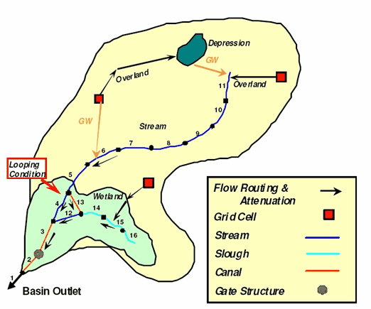
Stream Routing collects all side flows (surface runoff and groundwater percolation) to each individual stream reach and routes the flow hydrodynamically through the stream network by the BLASRoute sub-model. The hydrodynamic routing technique accommodates looped systems and multiple complex flow control structures including pumps, gates, weirs, and culverts. WAM's GIS interface includes an automated process of coding the reaches. With minimal information from the user, the program will automatically code the reaches starting at the outlets of the basin and working upstream to the headwaters. Tools are also provides to allow the user to manually change reach destinations. Additional point sources and surface and groundwater withdrawals can be applied to any stream reach, as needed. See the Technical Manual for additional details.